
Make a donation
Gear up for your next adventure:
As an Amazon Associate, this site earns from qualifying purchases at no extra cost to you.
Jagel topographic map
Click on the map to display elevation.
Make a donation
Gear up for your next adventure:
As an Amazon Associate, this site earns from qualifying purchases at no extra cost to you.
About this map
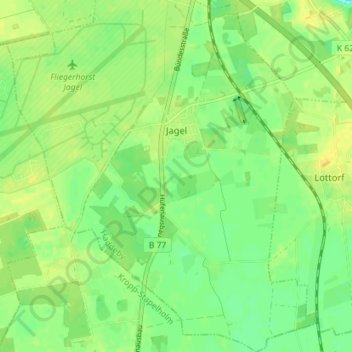
Name: Jagel topographic map, elevation, terrain.
Average elevation: 19 m
Minimum elevation: 0 m
Maximum elevation: 30 m
Make a donation
Gear up for your next adventure:
As an Amazon Associate, this site earns from qualifying purchases at no extra cost to you.
Other topographic maps
Click on a map to view its topography, its elevation and its terrain.
Glücksburg (Ostsee)
Deutschland > Schleswig-Holstein > Kreis Schleswig-Flensburg > Glücksburg (Ostsee)
Average elevation: 17 m
Steinberghaff
Deutschland > Schleswig-Holstein > Kreis Schleswig-Flensburg > Steinbergholz
Average elevation: 4 m
Make a donation
Gear up for your next adventure:
As an Amazon Associate, this site earns from qualifying purchases at no extra cost to you.
Terkelstoft
Deutschland > Schleswig-Holstein > Kreis Schleswig-Flensburg > Streichmühle
Average elevation: 29 m
Make a donation
Gear up for your next adventure:
As an Amazon Associate, this site earns from qualifying purchases at no extra cost to you.
Rückeberg
Deutschland > Schleswig-Holstein > Kreis Schleswig-Flensburg > Kappeln
Average elevation: 12 m
Make a donation
Gear up for your next adventure:
As an Amazon Associate, this site earns from qualifying purchases at no extra cost to you.
Uelsbyholz
Deutschland > Schleswig-Holstein > Kreis Schleswig-Flensburg > Uelsby
Average elevation: 44 m
Make a donation
Gear up for your next adventure:
As an Amazon Associate, this site earns from qualifying purchases at no extra cost to you.
Lüttfeld
Deutschland > Schleswig-Holstein > Kreis Schleswig-Flensburg > Kappeln
Average elevation: 12 m
Make a donation
Gear up for your next adventure:
As an Amazon Associate, this site earns from qualifying purchases at no extra cost to you.
Schausende
Deutschland > Schleswig-Holstein > Kreis Schleswig-Flensburg > Glücksburg (Ostsee)
Average elevation: 3 m
Make a donation
Gear up for your next adventure:
As an Amazon Associate, this site earns from qualifying purchases at no extra cost to you.
Sörupmühle
Deutschland > Schleswig-Holstein > Kreis Schleswig-Flensburg > Flatzby
Average elevation: 44 m
Brarupholz
Deutschland > Schleswig-Holstein > Kreis Schleswig-Flensburg > Scheggerott
Average elevation: 42 m
Ulsnisland
Deutschland > Schleswig-Holstein > Kreis Schleswig-Flensburg > Ulsnis
Average elevation: 13 m
Alt Hasselberg
Deutschland > Schleswig-Holstein > Kreis Schleswig-Flensburg > Hasselberg
Average elevation: 3 m
Make a donation
Gear up for your next adventure:
As an Amazon Associate, this site earns from qualifying purchases at no extra cost to you.
Tolkschuby
Deutschland > Schleswig-Holstein > Kreis Schleswig-Flensburg > Tolk
Average elevation: 23 m
Rabenkirchen
Deutschland > Schleswig-Holstein > Kreis Schleswig-Flensburg > Rabenkirchen-Faulück
Average elevation: 31 m
Make a donation
Gear up for your next adventure:
As an Amazon Associate, this site earns from qualifying purchases at no extra cost to you.
Ulegraff
Deutschland > Schleswig-Holstein > Kreis Schleswig-Flensburg > Brunsholm
Average elevation: 43 m
Gammelbyholz
Deutschland > Schleswig-Holstein > Kreis Schleswig-Flensburg > Sörup
Average elevation: 38 m
Make a donation
Gear up for your next adventure:
As an Amazon Associate, this site earns from qualifying purchases at no extra cost to you.
Altholzkrug
Deutschland > Schleswig-Holstein > Kreis Schleswig-Flensburg > Handewitt
Average elevation: 40 m
Make a donation
Gear up for your next adventure:
As an Amazon Associate, this site earns from qualifying purchases at no extra cost to you.
Süderbraruproy
Deutschland > Schleswig-Holstein > Kreis Schleswig-Flensburg > Süderbrarup > Dollrottfeld
Average elevation: 25 m
Unewattfeld
Deutschland > Schleswig-Holstein > Kreis Schleswig-Flensburg > Unewatt
Average elevation: 27 m
Steinberggaard
Deutschland > Schleswig-Holstein > Kreis Schleswig-Flensburg > Steinberg
Average elevation: 15 m
Osterholz
Deutschland > Schleswig-Holstein > Kreis Schleswig-Flensburg > Westerholz
Average elevation: 13 m
Make a donation
Gear up for your next adventure:
As an Amazon Associate, this site earns from qualifying purchases at no extra cost to you.
Lüttfeld
Deutschland > Schleswig-Holstein > Kreis Schleswig-Flensburg > Kappeln
Average elevation: 12 m
Schnarup
Deutschland > Schleswig-Holstein > Kreis Schleswig-Flensburg > Schnarup-Thumby
Average elevation: 31 m
Make a donation
Gear up for your next adventure:
As an Amazon Associate, this site earns from qualifying purchases at no extra cost to you.