
Casuntingan topographic map
Interactive map
Click on the map to display elevation.
Casuntingan
It is one of the two (the other one being the municipality of Consolacion) local government units located within the mainland Metro Cebu where the elevation of land is less than 100 m (330 ft).
About this map
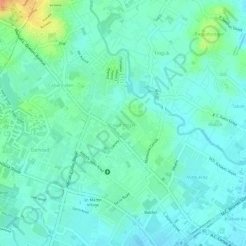
Name: Casuntingan topographic map, elevation, terrain.
Location: Casuntingan, Mandaue, Central Visayas, Philippines (10.33870 123.92593 10.35487 123.93561)
Average elevation: 21 m
Minimum elevation: 8 m
Maximum elevation: 56 m
Other topographic maps
Click on a map to view its topography, its elevation and its terrain.
Basak
It is one of the two (the other one being the municipality of Consolacion) local government units located within the mainland Metro Cebu where the elevation of land is less than 100 m (330 ft).
Average elevation: 14 m