
Trongsa Dzongkhag topographic map
Interactive map
Click on the map to display elevation.
About this map
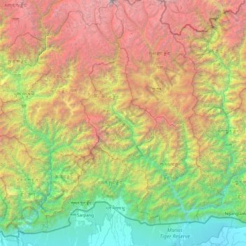
Name: Trongsa Dzongkhag topographic map, elevation, terrain.
Location: Trongsa Dzongkhag, Trongsa District, Bhutan (26.65000 89.83333 28.05000 91.23333)
Average elevation: 2,423 m
Minimum elevation: 49 m
Maximum elevation: 7,453 m