
Hassi Gara topographic map
Interactive map
Click on the map to display elevation.
About this map
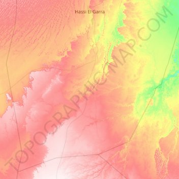
Name: Hassi Gara topographic map, elevation, terrain.
Location: Hassi Gara, El Menia District, El Menia, Algeria (28.89785 1.90301 30.60086 4.03388)
Average elevation: 433 m
Minimum elevation: 279 m
Maximum elevation: 609 m
Hassi Gara is located almost at the center of Algeria, lying at the eastern border of the Grand Erg Occidental at an elevation of 380 metres (1,250 ft). The town is centered in the El Goléa oasis; to the east dramatic cliffs rise up to 200 metres (660 ft) above the town.