
East Point topographic map
Interactive map
Click on the map to display elevation.
About this map
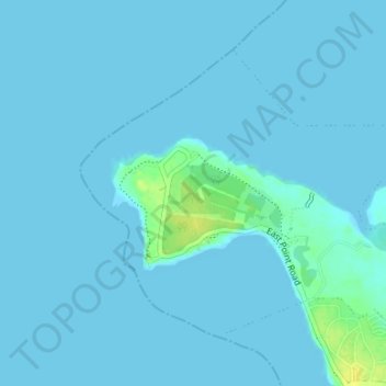
Name: East Point topographic map, elevation, terrain.
Location: East Point, City of Darwin, Northern Territory, Australia (-12.42043 130.81247 -12.39625 130.84569)
Average elevation: 2 m
Minimum elevation: 0 m
Maximum elevation: 20 m
Other topographic maps
Click on a map to view its topography, its elevation and its terrain.
Darwin
Darwin, City of Darwin, Northern Territory, 0800, Australia
Average elevation: 8 m
Rapid Creek
Australia > City of Darwin > Darwin
Rapid Creek, Brinkin, Darwin, City of Darwin, Northern Territory, 0810, Australia
Average elevation: 12 m