Geolocate

Laughton topographic map

Click on the map to display elevation.

About this map

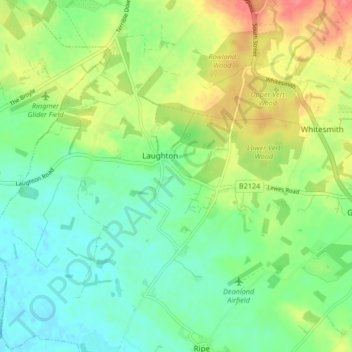
Name: Laughton topographic map, elevation, terrain.

Location: Laughton, Wealden, East Sussex, England, United Kingdom (50.86981 0.09185 50.92193 0.17561)

Average elevation: 24 m

Minimum elevation: 1 m

Maximum elevation: 62 m

East Sussex trails, hiking, mountain biking, running and outdoor activities

Gear up for your next adventure:

🧥Waterproof Hiking Jackets - Rain protection for walking in all weather conditions
📢Survival Whistles - Essential safety gear for signaling for help in mountain fog
🧷Tenacious Repair Tape - Instant fix for torn tents, jackets, or dry bags
🛌Sleeping Mats - Insulated mats for comfortable outdoor sleeping
🛰️Outdoor GPS Navigation - Navigation devices for remote and off-grid areas

As an Amazon Associate, this site earns from qualifying purchases at no extra cost to you.