
Thanat topographic map
Interactive map
Click on the map to display elevation.
About this map
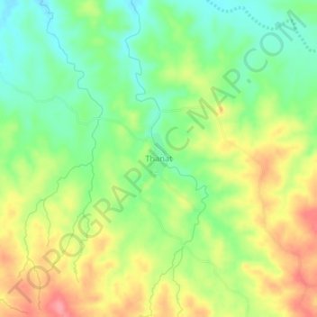
Name: Thanat topographic map, elevation, terrain.
Location: Thanat, Aunglan Township, Thayet District, Magway, Myanmar (19.36124 95.25891 19.40124 95.29891)
Average elevation: 104 m
Minimum elevation: 63 m
Maximum elevation: 154 m