
Mank topographic map
Interactive map
Click on the map to display elevation.
About this map
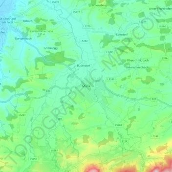
Name: Mank topographic map, elevation, terrain.
Location: Mank, Gemeinde Mank, Bezirk Melk, Lower Austria, 3240, Austria (48.07107 15.30103 48.15107 15.38103)
Average elevation: 315 m
Minimum elevation: 237 m
Maximum elevation: 551 m