Geolocate

Burien topographic map

Click on the map to display elevation.

About this map

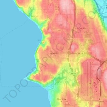
Name: Burien topographic map, elevation, terrain.

Location: Burien, King County, Washington, 98166-1824, United States (47.42992 -122.38853 47.50992 -122.30853)

Average elevation: 65 m

Minimum elevation: -1 m

Maximum elevation: 149 m

Gear up for your next adventure:

🧴Sport Sunscreen Sticks - High-protection sunblock that won't run into your eyes on the trail
🗺️Ordnance Survey Maps - Official UK maps for walking and outdoor activities
👖Packable Overtrousers - Quick-deploy rain protection for legs in sudden storms
📚UK Hiking Guidebooks - Detailed route descriptions for the Lake District, Peaks, and Highlands
🍱Food Containers - Reusable containers for outdoor meals

As an Amazon Associate, this site earns from qualifying purchases at no extra cost to you.