
Ohrid topographic map
Interactive map
Click on the map to display elevation.
About this map
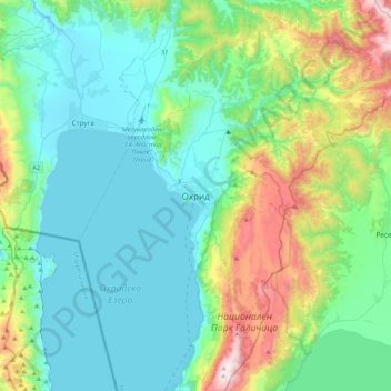
Name: Ohrid topographic map, elevation, terrain.
Average elevation: 963 m
Minimum elevation: 684 m
Maximum elevation: 1,977 m
Ohrid is located in the south-western part of North Macedonia, on the shore of Lake Ohrid, at an elevation of 695 meters above sea level.