
Kurtkowiec topographic map
Interactive map
Click on the map to display elevation.
About this map
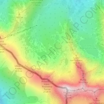
Name: Kurtkowiec topographic map, elevation, terrain.
Average elevation: 1,758 m
Minimum elevation: 1,406 m
Maximum elevation: 2,250 m
Other topographic maps
Click on a map to view its topography, its elevation and its terrain.
Wielki Giewont
Poland > Lesser Poland Voivodeship > Tatra County > Zakopane
Wielki Giewont, Zakopane, Tatra County, Lesser Poland Voivodeship, Poland
Average elevation: 1,478 m
Tatry
Poland > Lesser Poland Voivodeship > Tatra County > Zakopane
Tatry, Zakopane, Tatra County, Lesser Poland Voivodeship, Poland
Average elevation: 1,647 m