
Hameau des Pelletiers topographic map
Interactive map
Click on the map to display elevation.
About this map
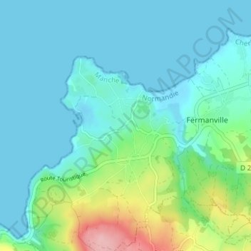
Name: Hameau des Pelletiers topographic map, elevation, terrain.
Average elevation: 26 m
Minimum elevation: -1 m
Maximum elevation: 134 m
Other topographic maps
Click on a map to view its topography, its elevation and its terrain.
Hameau du Cap Lévi
France > Normandie > Manche > Fermanville
Hameau du Cap Lévi, Fermanville, Cherbourg, Manche, Normandie, France métropolitaine, 50840, France
Average elevation: 15 m
Intheville
France > Normandie > Manche > Fermanville
Intheville, Fermanville, Cherbourg, Manche, Normandie, France métropolitaine, 50840, France
Average elevation: 28 m
Inglemare
France > Normandie > Manche > Fermanville
Inglemare, Fermanville, Cherbourg, Manche, Normandie, France métropolitaine, 50840, France
Average elevation: 21 m