
Ngerbodel topographic map
Interactive map
Click on the map to display elevation.
About this map
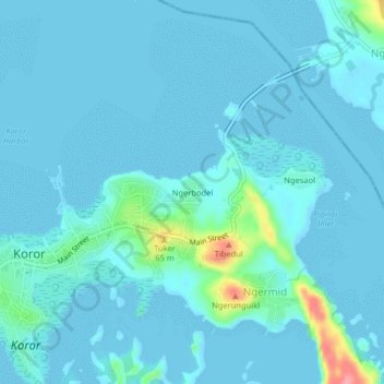
Name: Ngerbodel topographic map, elevation, terrain.
Location: Ngerbodel, Koror, Palau (7.32964 134.47382 7.36964 134.51382)
Average elevation: 10 m
Minimum elevation: -1 m
Maximum elevation: 98 m
Other topographic maps
Click on a map to view its topography, its elevation and its terrain.