
Bunker Hill topographic map
Interactive map
Click on the map to display elevation.
About this map
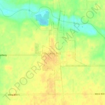
Name: Bunker Hill topographic map, elevation, terrain.
Location: Bunker Hill, Miami County, Indiana, United States (40.65006 -86.10786 40.67154 -86.09148)
Average elevation: 244 m
Minimum elevation: 225 m
Maximum elevation: 255 m
Other topographic maps
Click on a map to view its topography, its elevation and its terrain.
Amboy
United States > Indiana > Miami County
Amboy, Miami County, Indiana, United States
Average elevation: 251 m
Maconaquah Park
United States > Indiana > Miami County > Peru > South Peru
Maconaquah Park, South Peru, Peru, Miami County, Indiana, United States
Average elevation: 214 m
Ridgeview
United States > Indiana > Miami County > Peru
Ridgeview, Peru, Miami County, Indiana, 46970, United States
Average elevation: 205 m
Loree
United States > Indiana > Miami County
Loree, Miami County, Indiana, 46914, United States
Average elevation: 246 m