
Quernmore topographic map
Click on the map to display elevation.
About this map
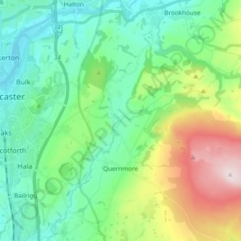
Name: Quernmore topographic map, elevation, terrain.
Location: Quernmore, Lancaster, Lancashire, England, United Kingdom (54.00261 -2.78944 54.07881 -2.67760)
Average elevation: 131 m
Minimum elevation: 2 m
Maximum elevation: 468 m
Lancashire trails, hiking, mountain biking, running and outdoor activities
Other topographic maps
Click on a map to view its topography, its elevation and its terrain.
Silverdale Green
United Kingdom > England > Lancashire > Lancaster > Silverdale
Average elevation: 24 m