
Thank you for supporting this site ❤️
Make a donation
Make a donation
Gear up for your next adventure:
As an Amazon Associate, this site earns from qualifying purchases at no extra cost to you.
Ferhet topographic map
Click on the map to display elevation.
Thank you for supporting this site ❤️
Make a donation
Make a donation
Gear up for your next adventure:
As an Amazon Associate, this site earns from qualifying purchases at no extra cost to you.
About this map
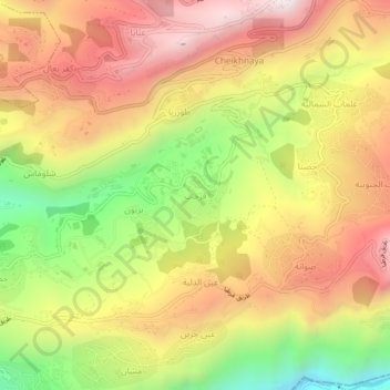
Name: Ferhet topographic map, elevation, terrain.
Location: Ferhet, Jbeil District, Keserwan-Jbeil Governorate, Lebanon (34.08035 35.74176 34.12035 35.78176)
Average elevation: 912 m
Minimum elevation: 402 m
Maximum elevation: 1,336 m
Thank you for supporting this site ❤️
Make a donation
Make a donation
Gear up for your next adventure:
As an Amazon Associate, this site earns from qualifying purchases at no extra cost to you.