
Ohiopyle State Park topographic map
Interactive map
Click on the map to display elevation.
About this map
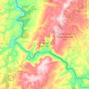
Name: Ohiopyle State Park topographic map, elevation, terrain.
Average elevation: 602 m
Minimum elevation: 298 m
Maximum elevation: 891 m
Other topographic maps
Click on a map to view its topography, its elevation and its terrain.
Bear Run
États-Unis d'Amérique > Pennsylvanie > Fayette County > Stewart Township
Bear Run, Stewart Township, Fayette County, Pennsylvanie, 15464, États-Unis d'Amérique
Average elevation: 450 m