
Manuganahalli topographic map
Interactive map
Click on the map to display elevation.
About this map
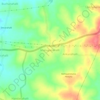
Name: Manuganahalli topographic map, elevation, terrain.
Average elevation: 815 m
Minimum elevation: 782 m
Maximum elevation: 857 m
Other topographic maps
Click on a map to view its topography, its elevation and its terrain.
Kodagu Kaloni
India > Karnataka > Hunasuru taluk
Kodagu Kaloni, Hunasuru taluk, Mysuru district, Karnataka, India
Average elevation: 785 m
Halebidu
India > Karnataka > Hunasuru taluk
Halebidu, Hunasuru taluk, Mysuru district, Karnataka, 571103, India
Average elevation: 787 m