
Fort Plains topographic map
Interactive map
Click on the map to display elevation.
About this map
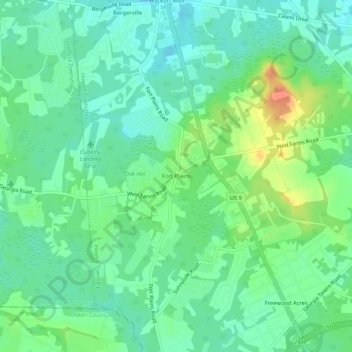
Name: Fort Plains topographic map, elevation, terrain.
Average elevation: 36 m
Minimum elevation: 22 m
Maximum elevation: 65 m
Other topographic maps
Click on a map to view its topography, its elevation and its terrain.
Freewood Acres
United States > New Jersey > Monmouth County > Howell Township
Freewood Acres, Howell Township, Monmouth County, New Jersey, 07731, United States
Average elevation: 37 m
Oak Glen
United States > New Jersey > Monmouth County > Howell Township
Oak Glen, Howell Township, Monmouth County, New Jersey, 07731, United States
Average elevation: 29 m
Fairfield
United States > New Jersey > Monmouth County > Howell Township
Fairfield, Howell Township, Monmouth County, New Jersey, 07710, United States
Average elevation: 31 m