
Thank you for supporting this site ❤️
Make a donation
Make a donation
Gear up for your next adventure:
As an Amazon Associate, this site earns from qualifying purchases at no extra cost to you.
Prietitz topographic map
Click on the map to display elevation.
Thank you for supporting this site ❤️
Make a donation
Make a donation
Gear up for your next adventure:
As an Amazon Associate, this site earns from qualifying purchases at no extra cost to you.
About this map
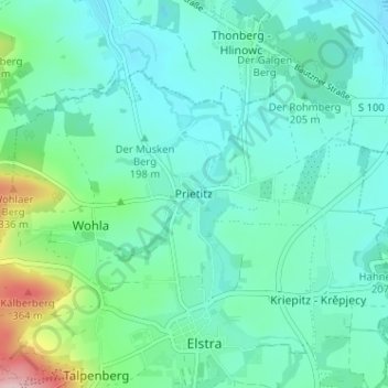
Name: Prietitz topographic map, elevation, terrain.
Location: Prietitz, Elstra, Bautzen, Sachsen, 01920, Deutschland (51.21598 14.11328 51.25598 14.15328)
Average elevation: 215 m
Minimum elevation: 171 m
Maximum elevation: 396 m
Thank you for supporting this site ❤️
Make a donation
Make a donation
Gear up for your next adventure:
As an Amazon Associate, this site earns from qualifying purchases at no extra cost to you.