
Cedar Creek Falls topographic map
Interactive map
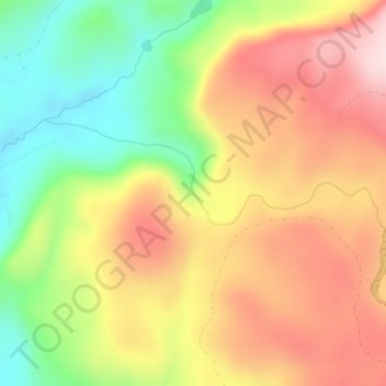
Click on the map to display elevation.
About this map
Name: Cedar Creek Falls topographic map, elevation, terrain.
Average elevation: 440 m
Minimum elevation: 260 m
Maximum elevation: 610 m
Other topographic maps
Click on a map to view its topography, its elevation and its terrain.
East Renton Highlands
United States of America > Washington > East Renton Highlands > East Renton Highlands
East Renton Highlands, King County, Washington, United States of America
Average elevation: 159 m
Clyde Hill
United States of America > Washington > Clyde Hill > Clyde Hill
Clyde Hill, King County, Washington, United States of America
Average elevation: 48 m
Clark County
United States of America > Washington
Clark County, Washington, United States of America
Average elevation: 266 m
Douglas County
United States of America > Washington
Douglas County, Washington, United States of America
Average elevation: 634 m
Western Junction
United States of America > Washington > Western Junction
Western Junction, Thurston County, Washington, United States of America
Average elevation: 114 m
Christmas Creek
United States of America > Washington
Christmas Creek, Jefferson County, Washington, United States of America
Average elevation: 242 m
Bellingham
United States of America > Washington > Bellingham
Bellingham, Whatcom County, Washington, United States of America
Average elevation: 89 m
Cheney
United States of America > Washington > Cheney
Cheney, Spokane County, Washington, 99024, United States of America
Average elevation: 725 m
Danville
United States of America > Washington > Maple Valley > Danville
Danville, Maple Valley, King County, Washington, 98038, United States of America
Average elevation: 174 m
Alice Creek
United States of America > Washington
Alice Creek, King County, Washington, United States of America
Average elevation: 999 m
Bellevue
United States of America > Washington > Bellevue
Bellevue, King County, Washington, 98004-4452, United States of America
Average elevation: 88 m
West Kelso
United States of America > Washington > Kelso > West Kelso
West Kelso, Kelso, Cowlitz County, Washington, 98626, United States of America
Average elevation: 26 m
Mount Lindsay
United States of America > Washington
Mount Lindsay, King County, Washington, United States of America
Average elevation: 1,065 m
Mac's Cove
United States of America > Washington > Cornet
Mac's Cove, Discovery Trail, Cornet, Island County, Washington, United States of America
Average elevation: 25 m
Cathcart
United States of America > Washington > Cathcart
Cathcart, Snohomish County, Washington, 98296, United States of America
Average elevation: 105 m
Deception Pass
United States of America > Washington > Rosario Beach
Deception Pass, Deception Pass Bridge, Deception Pass Shores, Rosario Beach, Skagit County, Washington, 98221, United States of America
Average elevation: 28 m
Tukwila
United States of America > Washington > Tukwila
Tukwila, King County, Washington, United States of America
Average elevation: 59 m
Duvall
United States of America > Washington > Duvall
Duvall, King County, Washington, United States of America
Average elevation: 50 m
Walla Walla
United States of America > Washington > Walla Walla
Walla Walla, Walla Walla County, Washington, United States of America
Average elevation: 297 m