Geolocate

Holm topographic map

Click on the map to display elevation.

About this map
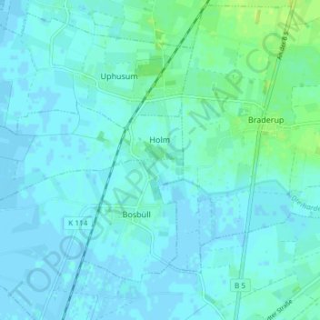
Name: Holm topographic map, elevation, terrain.

Location: Holm, Südtondern, Northern Friesland, Schleswig-Holstein, Germany (54.82247 8.79791 54.83879 8.87207)

Average elevation: 3 m

Minimum elevation: -2 m

Maximum elevation: 13 m

Other topographic maps

Click on a map to view its topography, its elevation and its terrain.
Gear up for your next adventure:

🧴Sport Sunscreen Sticks - High-protection sunblock that won't run into your eyes on the trail
🐕Hiking Dog Harnesses - Rugged harnesses for taking your companion on mountain trails
🥾Hiking Boots - Waterproof and durable boots for long-distance hiking in the UK
🛰️Handheld GPS Devices - Reliable GPS units for hiking and outdoor navigation
🔋Rechargeable Batteries - Eco-friendly power for headlamps and older GPS units

As an Amazon Associate, this site earns from qualifying purchases at no extra cost to you.