
Ain M'lila topographic map
Interactive map
Click on the map to display elevation.
About this map
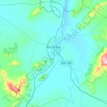
Name: Ain M'lila topographic map, elevation, terrain.
Location: Ain M'lila, Aïn M'Lila District, Oum El Bouaghi, Algeria (35.92649 6.45694 36.12477 6.66754)
Average elevation: 855 m
Minimum elevation: 755 m
Maximum elevation: 1,723 m