Geolocate

Tonge topographic map

Click on the map to display elevation.

About this map

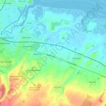
Name: Tonge topographic map, elevation, terrain.

Location: Tonge, Bapchild, Borough of Swale, Kent, England, United Kingdom (51.30225 0.75910 51.36539 0.82285)

Average elevation: 23 m

Minimum elevation: -4 m

Maximum elevation: 86 m

Kent trails, hiking, mountain biking, running and outdoor activities

Gear up for your next adventure:

🎿Telescopic Trekking Poles - Reduces knee strain on steep topographic descents
🧭Emergency Beacons - Safety beacons for remote outdoor locations
🧤Waterproof Overmitts - Extreme weather protection for hikers and mountaineers
🗺️Scratch-off Peak Maps - Track your progress climbing Munros or Wainwrights
🛰️Satellite Messengers - Emergency communication devices for areas without mobile signal

As an Amazon Associate, this site earns from qualifying purchases at no extra cost to you.