Geolocate

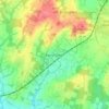
Cowfold topographic map

Click on the map to display elevation.

About this map

Name: Cowfold topographic map, elevation, terrain.

Location: Cowfold, Horsham, West Sussex, England, United Kingdom (50.96460 -0.30523 51.01414 -0.22955)

Average elevation: 32 m

Minimum elevation: 6 m

Maximum elevation: 96 m

West Sussex trails, hiking, mountain biking, running and outdoor activities

Other topographic maps

Click on a map to view its topography, its elevation and its terrain.
Horsham

United Kingdom > England > West Sussex > Horsham

Average elevation: 62 m

Cootham

United Kingdom > England > West Sussex > Horsham > Storrington

Average elevation: 51 m

Wiggonholt

United Kingdom > England > West Sussex > Horsham > Wiggonholt

Average elevation: 17 m

Hardham

United Kingdom > England > West Sussex > Horsham > Coldwaltham

Average elevation: 13 m

Wineham

United Kingdom > England > West Sussex > Horsham

Average elevation: 18 m

Barns Green

United Kingdom > England > West Sussex > Horsham

Average elevation: 49 m

Horsham

United Kingdom > England > West Sussex > Horsham

Average elevation: 62 m

Hardham

United Kingdom > England > West Sussex > Horsham > Coldwaltham

Average elevation: 13 m

Horsham

United Kingdom > England > West Sussex > Horsham

Average elevation: 62 m

Gear up for your next adventure:

📦Dry Bags - Waterproof bags to protect gear from rain
🚶Walking Pedometers - Simple distance tracking for casual trail walkers
🎒Hiking Daypacks - Compact backpacks ideal for short hikes and excursions
🔋Solar Power Banks - Keep your GPS and phone charged during multi-day expeditions
🔋Rechargeable Batteries - Eco-friendly power for headlamps and older GPS units

As an Amazon Associate, this site earns from qualifying purchases at no extra cost to you.