

Harrow topographic map
Click on the map to display elevation.
Harrow
The town centre is about 220 feet (67 m) above sea level, almost 200 feet (61 m) below the top of Harrow Hill, which is an outlying knoll. The hill is half a mile south of the town centre, and the settlement is rich with historic architecture and has a village atmosphere. The steep climb towards the hill is clearly visible from Lowlands Road. Other parts of Harrow are not as affluent but are still mostly leafy, particularly the northern part called Harrow Weald. The rural northern slopes of Harrow, around Harrow Weald Common, are part of the Green Belt and contain a conservation area and a Site of Special Scientific Interest (SSSI) adjacent to another SSSI called Bentley Priory Nature Reserve which comes under Stanmore. The area also has the highest elevation in Harrow, as high as 492 feet (150 m) above sea level.
About this map
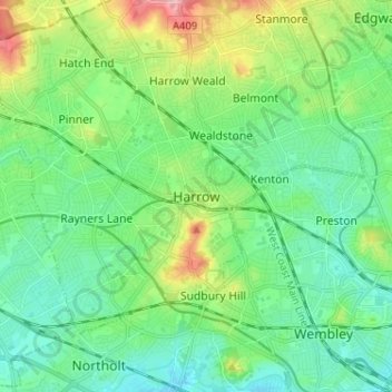
Name: Harrow topographic map, elevation, terrain.
Average elevation: 57 m
Minimum elevation: 24 m
Maximum elevation: 146 m
England trails, hiking, mountain biking, running and outdoor activities