
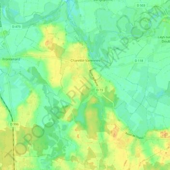
Charette-Varennes topographic map
Interactive map
Click on the map to display elevation.
About this map
Name: Charette-Varennes topographic map, elevation, terrain.
Average elevation: 184 m
Minimum elevation: 172 m
Maximum elevation: 201 m
Other topographic maps
Click on a map to view its topography, its elevation and its terrain.
La Pommelée
Frankreich > Burgund und Freigrafschaft > Charette-Varennes > La Pommelée
La Pommelée, Charette, Charette-Varennes, Louhans, Saône-et-Loire, Burgund und Freigrafschaft, Metropolitanes Frankreich, 71270, Frankreich
Average elevation: 185 m