
Lugoff topographic map
Interactive map
Click on the map to display elevation.
About this map
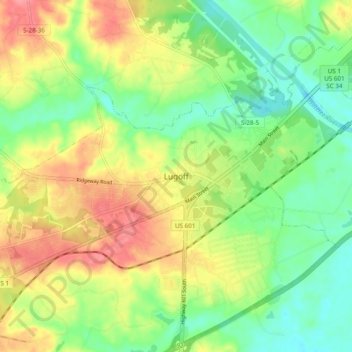
Name: Lugoff topographic map, elevation, terrain.
Location: Lugoff, Kershaw County, South Carolina, 29078, USA (34.18737 -80.72925 34.26737 -80.64925)
Average elevation: 70 m
Minimum elevation: 35 m
Maximum elevation: 115 m