
Mualim topographic map
Interactive map
Click on the map to display elevation.
About this map
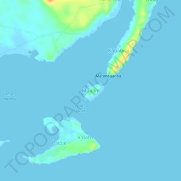
Name: Mualim topographic map, elevation, terrain.
Location: Mualim, East New Britain, Islands Region, Papua New Guinea (-4.23864 152.44471 -4.19864 152.48471)
Average elevation: 3 m
Minimum elevation: -2 m
Maximum elevation: 41 m
Other topographic maps
Click on a map to view its topography, its elevation and its terrain.
Mauna
Papua New Guinea > East New Britain
Mauna, East New Britain, Islands Region, Papua New Guinea
Average elevation: 17 m
Rabaul
Papua New Guinea > East New Britain
Rabaul, East New Britain, Islands Region, Papua New Guinea
Average elevation: 48 m
Tokua Plantation
Papua New Guinea > East New Britain > Tokua Plantation
Tokua Plantation, East New Britain, Islands Region, Papua New Guinea
Average elevation: 16 m
Duke of York Islands
Papua New Guinea > East New Britain
Duke of York Islands, Kokopo District, East New Britain, Islands Region, Papua New Guinea
Average elevation: 116 m