
Thank you for supporting this site ❤️
Make a donation
Make a donation
Gear up for your next adventure:
As an Amazon Associate, this site earns from qualifying purchases at no extra cost to you.
Soffranco topographic map
Click on the map to display elevation.
Thank you for supporting this site ❤️
Make a donation
Make a donation
Gear up for your next adventure:
As an Amazon Associate, this site earns from qualifying purchases at no extra cost to you.
About this map
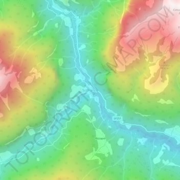
Name: Soffranco topographic map, elevation, terrain.
Location: Soffranco, Longarone, Belluno, Veneto, 32013, Italia (46.25815 12.22433 46.29815 12.26433)
Average elevation: 1,052 m
Minimum elevation: 496 m
Maximum elevation: 1,980 m
Thank you for supporting this site ❤️
Make a donation
Make a donation
Gear up for your next adventure:
As an Amazon Associate, this site earns from qualifying purchases at no extra cost to you.