
Thank you for supporting this site ❤️
Make a donation
Make a donation
Gear up for your next adventure:
As an Amazon Associate, this site earns from qualifying purchases at no extra cost to you.
Maligaon topographic map
Click on the map to display elevation.
Thank you for supporting this site ❤️
Make a donation
Make a donation
Gear up for your next adventure:
As an Amazon Associate, this site earns from qualifying purchases at no extra cost to you.
About this map
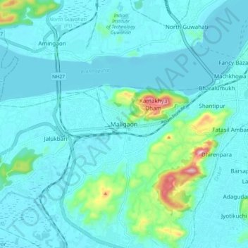
Name: Maligaon topographic map, elevation, terrain.
Location: Maligaon, Guwahati, Kamrup Metropolitan, Assam, 781010, India (26.12005 91.65581 26.20005 91.73581)
Average elevation: 71 m
Minimum elevation: 40 m
Maximum elevation: 285 m
Thank you for supporting this site ❤️
Make a donation
Make a donation
Gear up for your next adventure:
As an Amazon Associate, this site earns from qualifying purchases at no extra cost to you.