
San Felipe topographic map
Interactive map
Click on the map to display elevation.
About this map
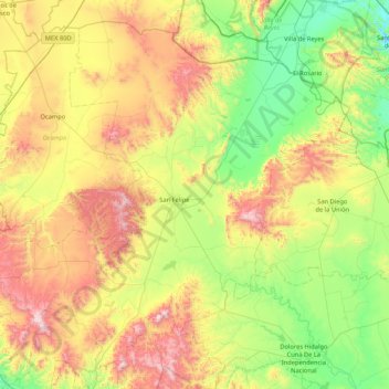
Name: San Felipe topographic map, elevation, terrain.
Location: San Felipe, Guanajuato, México (21.13624 -101.67976 21.83942 -100.83432)
Average elevation: 2,167 m
Minimum elevation: 1,736 m
Maximum elevation: 2,950 m
Other topographic maps
Click on a map to view its topography, its elevation and its terrain.
Guanajuato
México > Guanajuato > Municipio de Guanajuato
Guanajuato, Municipio de Guanajuato, Guanajuato, 36015, México
Average elevation: 2,182 m
Acámbaro
México > Guanajuato > Acámbaro > Acámbaro
Acámbaro, Guanajuato, 38600, México
Average elevation: 1,897 m
San Miguel de Allende
México > Guanajuato > San Miguel de Allende
San Miguel de Allende, Guanajuato, México
Average elevation: 1,964 m