Geolocate

Devmali topographic map

Click on the map to display elevation.

About this map

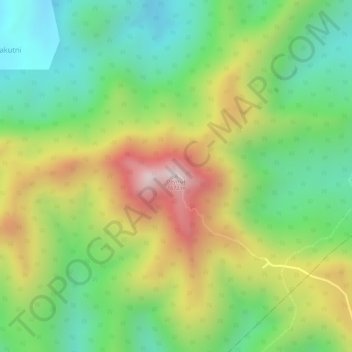
Name: Devmali topographic map, elevation, terrain.

Location: Devmali, Pottangi, Koraput, Odisha, India (18.67507 82.98203 18.67517 82.98213)

Average elevation: 1,339 m

Minimum elevation: 1,094 m

Maximum elevation: 1,666 m

Gear up for your next adventure:

🧷Tenacious Repair Tape - Instant fix for torn tents, jackets, or dry bags
🗺️Topographic Maps - Detailed maps showing elevation and terrain features
🧺Mesh Stuff Sacks - Breathable storage for wet gear or camp organization
🎒Multi-day Trekking Packs - Large capacity backpacks for wild camping and long-distance trails
🛌Sleeping Mats - Insulated mats for comfortable outdoor sleeping

As an Amazon Associate, this site earns from qualifying purchases at no extra cost to you.