Geolocate

Edendale topographic map

Click on the map to display elevation.

About this map
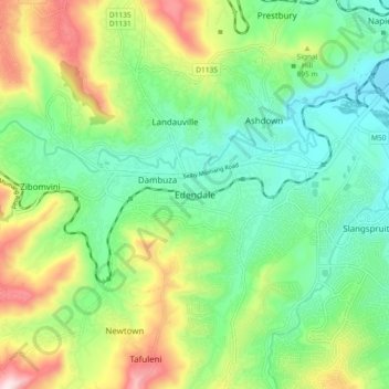
Name: Edendale topographic map, elevation, terrain.

Location: Edendale, Msunduzi Local Municipality, uMgungundlovu District Municipality, KwaZulu-Natal, 3216, South Africa (-29.69278 30.27472 -29.61278 30.35472)

Average elevation: 809 m

Minimum elevation: 632 m

Maximum elevation: 1,163 m

Other topographic maps

Click on a map to view its topography, its elevation and its terrain.

Gear up for your next adventure:

👕Technical Hiking Tees - Moisture-management for high-exertion climbs
🎿Telescopic Trekking Poles - Reduces knee strain on steep topographic descents
🎒Hiking Child Carriers - Explore the outdoors with the whole family safely
🥾Hiking Boot Waterproofing Wax - Maintain the lifespan of your leather trekking boots
🔦LED Camping Lanterns - Illumination for reading maps inside your tent at night

As an Amazon Associate, this site earns from qualifying purchases at no extra cost to you.