
Thank you for supporting this site ❤️
Make a donation
Make a donation
Gear up for your next adventure:
As an Amazon Associate, this site earns from qualifying purchases at no extra cost to you.
Escallani topographic map
Click on the map to display elevation.
Thank you for supporting this site ❤️
Make a donation
Make a donation
Gear up for your next adventure:
As an Amazon Associate, this site earns from qualifying purchases at no extra cost to you.
About this map
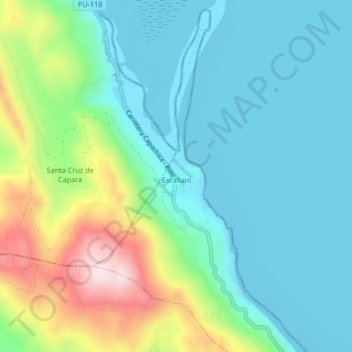
Name: Escallani topographic map, elevation, terrain.
Location: Escallani, Capachica, Puno, Perú (-15.51798 -69.91705 -15.47798 -69.87705)
Average elevation: 3,935 m
Minimum elevation: 3,807 m
Maximum elevation: 4,292 m
Thank you for supporting this site ❤️
Make a donation
Make a donation
Gear up for your next adventure:
As an Amazon Associate, this site earns from qualifying purchases at no extra cost to you.