
Thank you for supporting this site ❤️
Make a donation
Make a donation
Gear up for your next adventure:
As an Amazon Associate, this site earns from qualifying purchases at no extra cost to you.
Fengdu topographic map
Click on the map to display elevation.
Thank you for supporting this site ❤️
Make a donation
Make a donation
Gear up for your next adventure:
As an Amazon Associate, this site earns from qualifying purchases at no extra cost to you.
About this map
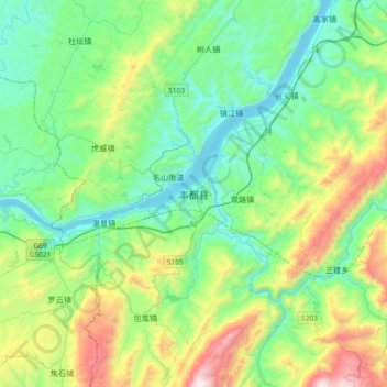
Name: Fengdu topographic map, elevation, terrain.
Location: Fengdu, Fengdu County, 渝东北三峡库区城镇群区位, Chongqing, China (29.70645 107.56577 30.02645 107.88577)
Average elevation: 538 m
Minimum elevation: 128 m
Maximum elevation: 1,703 m
Thank you for supporting this site ❤️
Make a donation
Make a donation
Gear up for your next adventure:
As an Amazon Associate, this site earns from qualifying purchases at no extra cost to you.