Côtes-de-Fer topographic map
Interactive map
Click on the map to display elevation.
About this map
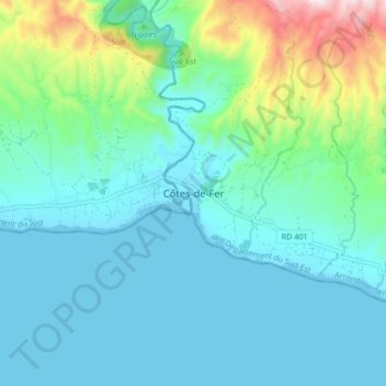
Name: Côtes-de-Fer topographic map, elevation, terrain.
Average elevation: 106 m
Minimum elevation: 0 m
Maximum elevation: 568 m

Click on the map to display elevation.
Name: Côtes-de-Fer topographic map, elevation, terrain.
Average elevation: 106 m
Minimum elevation: 0 m
Maximum elevation: 568 m