
Georgia topographic map
Click on the map to display elevation.
About this map
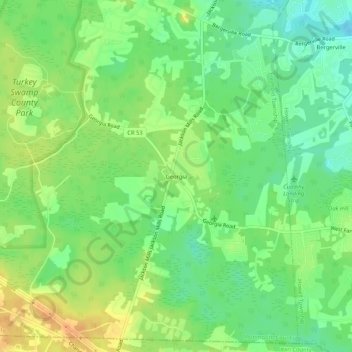
Name: Georgia topographic map, elevation, terrain.
Average elevation: 37 m
Minimum elevation: 21 m
Maximum elevation: 54 m
Other topographic maps
Click on a map to view its topography, its elevation and its terrain.
West Freehold
United States > New Jersey > Monmouth County > Freehold Township
Average elevation: 43 m
West Freehold
United States > New Jersey > Monmouth County > Freehold Township
Average elevation: 43 m