
Temple Hill topographic map
Interactive map
Click on the map to display elevation.
About this map
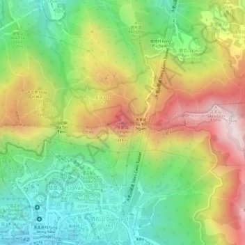
Name: Temple Hill topographic map, elevation, terrain.
Average elevation: 262 m
Minimum elevation: 19 m
Maximum elevation: 552 m
Other topographic maps
Click on a map to view its topography, its elevation and its terrain.
Wo Liu Hang Village
China > Hong Kong > Sha Tin District > Wo Liu Hang Village
Wo Liu Hang Village, Sha Tin District, New Territories, Hong Kong, China
Average elevation: 111 m
Wu Kai Sha Village
China > Hong Kong > Sha Tin District > Wu Kai Sha Village
Wu Kai Sha Village, Sha Tin District, New Territories, Hong Kong, China
Average elevation: 72 m
Nui Po Au
China > Hong Kong > Sha Tin District > Mui Tsz Lam
Nui Po Au, Mui Tsz Lam, Sha Tin District, New Territories, Hong Kong, China
Average elevation: 229 m