Geolocate

Spring Hill topographic map

Click on the map to display elevation.

About this map

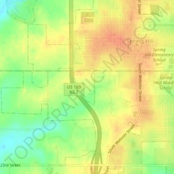
Name: Spring Hill topographic map, elevation, terrain.

Location: Spring Hill, Miami County, Kansas, United States (38.73305 -94.83864 38.73874 -94.83460)

Average elevation: 320 m

Minimum elevation: 293 m

Maximum elevation: 337 m

Gear up for your next adventure:

🧼Biodegradable Soap - Leave-no-trace hygiene for multi-day mountain treks
🧣Neck Gaiters - Versatile protection against wind and cold
👖Packable Overtrousers - Quick-deploy rain protection for legs in sudden storms
🧼Camping Hygiene Kits - Compact hygiene essentials for outdoor stays
🔦Outdoor Torches - Reliable torches for night navigation

As an Amazon Associate, this site earns from qualifying purchases at no extra cost to you.