
Chobe National Park topographic map
Interactive map
Click on the map to display elevation.
About this map
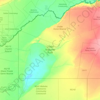
Name: Chobe National Park topographic map, elevation, terrain.
Location: Chobe National Park, Chobe District, Botswana (-19.33369 23.88217 -17.78777 25.18473)
Average elevation: 964 m
Minimum elevation: 918 m
Maximum elevation: 1,094 m
Other topographic maps
Click on a map to view its topography, its elevation and its terrain.