Geolocate

Cefa topographic map

Click on the map to display elevation.

About this map

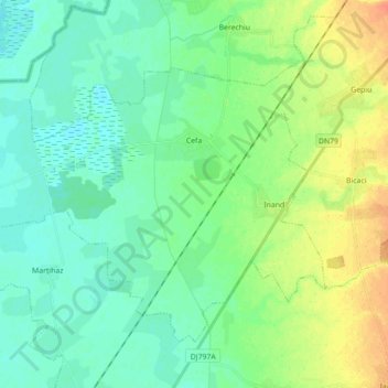
Name: Cefa topographic map, elevation, terrain.

Location: Cefa, Bihor, Romania (46.85186 21.59737 46.94361 21.77366)

Average elevation: 101 m

Minimum elevation: 90 m

Maximum elevation: 125 m

Gear up for your next adventure:

🧢Waterproof Hiking Hats - Keep the rain off your face while studying topographic maps
📕Outdoor Navigation Books - Learn traditional and modern navigation techniques
🗺️Topographic Maps - Detailed maps showing elevation and terrain features
🥼Base Layers - Thermal base layers for temperature regulation
🪓Outdoor Multitools - Versatile tools for hiking and camping

As an Amazon Associate, this site earns from qualifying purchases at no extra cost to you.