
Hôtel de Ville topographic map
Interactive map
Click on the map to display elevation.
About this map
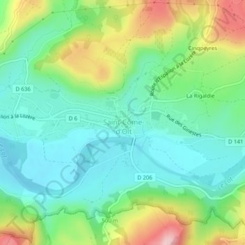
Name: Hôtel de Ville topographic map, elevation, terrain.
Average elevation: 407 m
Minimum elevation: 338 m
Maximum elevation: 552 m
Other topographic maps
Click on a map to view its topography, its elevation and its terrain.
Saupiac
France > Occitanie > Aveyron > Saint-Côme-d'Olt
Saupiac, Saint-Côme-d'Olt, Rodez, Aveyron, Occitanie, France métropolitaine, 12500, France
Average elevation: 531 m
La Rigaldie
France > Occitanie > Aveyron > Saint-Côme-d'Olt
La Rigaldie, Saint-Côme-d'Olt, Rodez, Aveyron, Occitanie, France métropolitaine, 12500, France
Average elevation: 451 m
Cinqpeyres
France > Occitanie > Aveyron > Saint-Côme-d'Olt
Cinqpeyres, Saint-Côme-d'Olt, Rodez, Aveyron, Occitanie, France métropolitaine, 12500, France
Average elevation: 466 m