Geolocate

Isabang topographic map

Click on the map to display elevation.

About this map

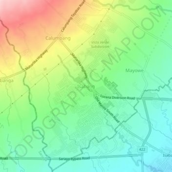
Name: Isabang topographic map, elevation, terrain.

Location: Isabang, Quezon, Calabarzon, 4327, Philippines (13.94464 121.54360 13.98464 121.58360)

Average elevation: 135 m

Minimum elevation: 54 m

Maximum elevation: 278 m

Gear up for your next adventure:

🥄Titanium Camping Sporks - The ultimate lightweight utensil for trail meals
🧦Merino Wool Hiking Socks - Moisture-wicking socks to prevent blisters during long mountain walks
💧Hydration Reservoirs - Convenient water bladders for hands-free drinking on the move
🧦Hiking Socks - Breathable socks designed to prevent blisters on long walks
📸Action Camera Chest Mounts - Record your ascent following topographic paths hands-free

As an Amazon Associate, this site earns from qualifying purchases at no extra cost to you.