Geolocate

Bulalang topographic map

Click on the map to display elevation.

About this map

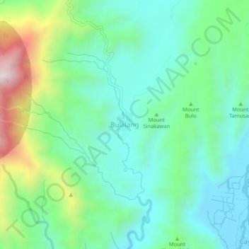
Name: Bulalang topographic map, elevation, terrain.

Location: Bulalang, Bukidnon, Northern Mindanao, Philippines (7.72557 125.34677 7.76557 125.38677)

Average elevation: 641 m

Minimum elevation: 442 m

Maximum elevation: 1,175 m

Gear up for your next adventure:

🧣Fleece Neck Warmers - Extra insulation for winter topographic surveys
🧺Mesh Stuff Sacks - Breathable storage for wet gear or camp organization
🔪Outdoor Multi-Tools - Versatile tools for gear repairs and food prep in the wild
🍲Portable Camping Stoves - Fast-boiling stoves for hot meals on remote topographic survey trips
🪓Outdoor Multitools - Versatile tools for hiking and camping

As an Amazon Associate, this site earns from qualifying purchases at no extra cost to you.