
Куст topographic map
Interactive map
Click on the map to display elevation.
About this map
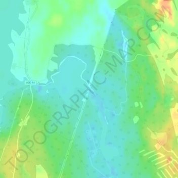
Name: Куст topographic map, elevation, terrain.
Average elevation: 143 m
Minimum elevation: 130 m
Maximum elevation: 169 m
Other topographic maps
Click on a map to view its topography, its elevation and its terrain.
Tolvayarvi
Russia > Republic of Karelia > Suojärvi District
Tolvayarvi, Loimola, Suojärvi District, Republic of Karelia, Northwestern Federal District, Russia
Average elevation: 182 m