Geolocate

Angat topographic map

Click on the map to display elevation.

About this map

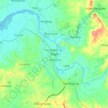
Name: Angat topographic map, elevation, terrain.

Location: Angat, Bulacan, Central Luzon, 3012, Philippines (14.89279 120.99192 14.97279 121.07192)

Average elevation: 52 m

Minimum elevation: 18 m

Maximum elevation: 144 m

Gear up for your next adventure:

🥾Women's Waterproof Hiking Boots - High-performance trekking boots designed for all-weather comfort
🧦Hiking Socks - Breathable socks designed to prevent blisters on long walks
🔦Waterproof LED Headlamps - Hands-free lighting for evening treks and emergency navigation
🧘Folding Sit Mats - Dry and warm seat for map-reading breaks on damp ground
🧣Neck Gaiters - Protects against wind and sun on exposed ridges and peaks

As an Amazon Associate, this site earns from qualifying purchases at no extra cost to you.