
Gorontalo topographic map
Interactive map
Click on the map to display elevation.
About this map
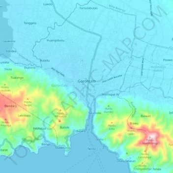
Name: Gorontalo topographic map, elevation, terrain.
Location: Gorontalo, Sulawesi, Indonesia (0.47966 122.99504 0.59013 123.09994)
Average elevation: 87 m
Minimum elevation: -1 m
Maximum elevation: 685 m
Other topographic maps
Click on a map to view its topography, its elevation and its terrain.