
Thank you for supporting this site ❤️
Make a donation
Make a donation
Gear up for your next adventure:
As an Amazon Associate, this site earns from qualifying purchases at no extra cost to you.
Vichuquén topographic map
Click on the map to display elevation.
Thank you for supporting this site ❤️
Make a donation
Make a donation
Gear up for your next adventure:
As an Amazon Associate, this site earns from qualifying purchases at no extra cost to you.
About this map
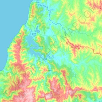
Name: Vichuquén topographic map, elevation, terrain.
Location: Vichuquén, Provincia de Curicó, Maule Region, Chile (-34.97455 -72.15826 -34.68453 -71.86849)
Average elevation: 130 m
Minimum elevation: -1 m
Maximum elevation: 461 m
Thank you for supporting this site ❤️
Make a donation
Make a donation
Gear up for your next adventure:
As an Amazon Associate, this site earns from qualifying purchases at no extra cost to you.