
Lavandeira topographic map
Interactive map
Click on the map to display elevation.
About this map
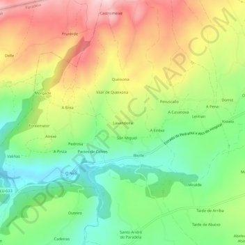
Name: Lavandeira topographic map, elevation, terrain.
Location: Lavandeira, Biville, Sarria, Lugo, Galicia, 27612, Spain (42.75731 -7.52347 42.79731 -7.48347)
Average elevation: 636 m
Minimum elevation: 509 m
Maximum elevation: 797 m